GlobWeather Channel Winter Weather Advisory Issued for Interior Alaska: 4–9 Inches of Snow Expected Through Friday
politics

Winter Weather Advisory Issued for Interior Alaska: 4–9 Inches of Snow Expected Through Friday

Onsnational Weather Service
October 04, 2025

The National Weather Service has issued a winter weather advisory for interior Alaska, forecasting 4 to 9 inches of snow from Thursday, October 2 through Friday, October 3. The advisory affects high-elevation areas including the White Mountains, Chatanika River Valley, and portions of the Steese and Elliott highways. Drivers and residents are urged to prepare for hazardous travel and icy conditions during commutes.

Interior Alaska Braces for Significant Early Season Snowfall

The National Weather Service (NWS) has issued a winter weather advisory for parts of interior Alaska, warning residents and travelers of heavy snow accumulation and hazardous travel conditions starting Thursday afternoon through Friday evening.

📍 Affected Areas:

  • White Mountains

  • Chatanika River Valley

  • High terrain south of the Yukon River

  • Sections of the Steese Highway (up to Mile 90)

  • Portions of the Elliott Highway


Advisory Timeline

  • Start: Thursday, October 2 at 2:00 PM (local time)

  • End: Friday, October 3 at 10:00 PM

The NWS office in Fairbanks expects 4 to 9 inches of snow, with higher elevations seeing the most accumulation, especially around Steese and Eagle Summits.


Hazardous Travel Conditions Ahead

Motorists are advised to use extreme caution, especially during the Thursday evening and Friday morning commutes. Slippery roads and poor visibility are likely as the snow intensifies overnight.

🛑 “Plan on slippery road conditions. The hazardous conditions could impact the Thursday evening and Friday morning commutes,”NWS Advisory

In addition to driving hazards, icy sidewalks and stairs pose a risk for slips and falls. Residents are urged to tread carefully and check outdoor surfaces before stepping out.


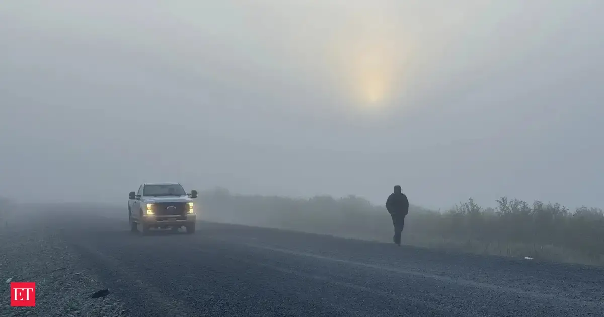
Snow Arrives Early in Fairbanks

The Fairbanks area has already seen its first measurable snowfall1.2 inches — nearly two weeks ahead of the typical seasonal average.

“According to records, the Fairbanks area typically gets their first inch of snow on October 9th. We’re ahead of schedule,” NWS Fairbanks noted on X (formerly Twitter).

Though the snow may not stay long, it's a clear sign that winter has arrived early in Alaska.


Forecast Breakdown by Elevation

  • Higher Elevations (White Mountains, Upper Chatanika Valley):
    Expect moderate to heavy snowfall, especially Thursday night into Friday.

  • Lower Elevations:
    Mixed precipitation is likely, leading to icy conditions without significant accumulation.


Stay Informed & Stay Safe

The NWS urges residents to:

  • Monitor 511 for updated road conditions

  • Follow official NWS social media for live updates

  • Prepare for commute delays

  • Use caution on all outdoor surfaces

As Alaska transitions into winter, preparedness is key—especially for communities relying on major travel routes affected by the incoming storm.

Wetter Newsletter

Holen Sie sich tägliche Wetteraktualisierungen und Benachrichtigungen direkt in Ihren Posteingang

Maumelle, Arkansas, United States of America

Klar

Current weather conditions icon 21.1°C

Heute

day weather conditions icon

24.6°C

17.2°C

2025-10-09

day weather conditions icon

26.3°C

14.3°C

2025-10-10

day weather conditions icon

26.7°C

12.1°C

2025-10-11

day weather conditions icon

30.2°C

15.7°C

Neueste Nachrichten zu United-states-of-america

  • Wetterumschwung in der Schweiz: Sturm Amy bringt Windspitzen und Temperatursturz

    Nach ruhigem Herbstwetter kündigt sich in der Schweiz ein markanter Wetterwechsel an. Verantwortlich ist das Orkantief Amy, das über den Atlantik zieht und am Samstag auch das Schweizer Wettergeschehen bestimmt. Mit Windspitzen, einem drastischen Temperatursturz und sinkender Schneefallgrenze steht ein turbulentes Wochenende bevor. Was Sie jetzt wissen und beachten müssen.

    October 05, 2025
  • Sturmwarnung für Deutschland: Bomben-Zyklon bringt Orkanböen und Wetterumschwung im Oktober

    Ein sogenannter Bomben-Zyklon entsteht aktuell vor den britischen Inseln – mit massiven Auswirkungen auch für Deutschland. Ab Samstag drohen schwere Sturmböen, Orkanstärke und Dauerregen. Der goldene Oktober macht damit zunächst Pause. Meteorologen erwarten allerdings zum Wochenbeginn erneut milde Temperaturen.

    October 03, 2025
  • Herbstwetter in NRW: Stürmisches Wochenende, aber warme Überraschung nächste Woche

    Das Wetter in Nordrhein-Westfalen wird in den kommenden Tagen stürmisch und ungemütlich – doch ein subtropisches Hoch bringt ab Montag überraschend milde Temperaturen zurück. Wetterexperte Dominik Jung liefert eine detaillierte Prognose für Oktober.

    October 03, 2025
  • Bomben-Zyklon im Anmarsch: Deutschland droht stürmisches Wochenende mit Orkanböen

    Ein ungewöhnlich starker Herbststurm rollt auf Deutschland zu: Ein sogenannter Bomben-Zyklon bildet sich vor den britischen Inseln und bringt am Wochenende orkanartige Böen, Starkregen und einen massiven Wetterumschwung mit sich. Meteorologen erwarten Windgeschwindigkeiten von bis zu 120 km/h auf dem Brocken, auch im Binnenland drohen stürmische Böen. Doch es gibt Hoffnung auf besseres Wetter in der kommenden Woche.

    October 01, 2025
  • Überraschende Wetter-Wende im Oktober möglich – von Nebelgrau zu Spätsommer?

    Während Deutschland sich im klassischen Herbstwetter einrichtet, könnte ein ungewöhnliches Wetterphänomen für eine kurzfristige Rückkehr sommerlicher Temperaturen sorgen. Ein Ex-Hurrikan über dem Atlantik lenkt möglicherweise subtropische Warmluft nach Mitteleuropa – mit erstaunlichen Auswirkungen auf das Wetter in Deutschland.

    October 01, 2025
Alle Nachrichten anzeigen